
Reviewed · ALTIPLANIC LAGOONS & SALT FLATS
From San Pedro de Atacama: The Salt Flats Route, Full day
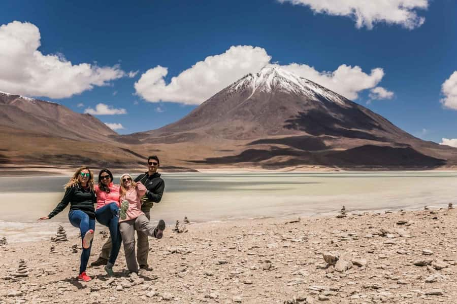
The Salt Flats Route climbs from San Pedro de Atacama into stark, high country, where Licancábur Volcano rises to 5,916 meters and flamingos feed in small mountain ponds. The scenery changes quickly from desert floor to lava, ash, salt, rock towers, and open altiplano.
I like the breakfast view of Licancábur and the chance to see wildlife in such a bare setting. I also like that pickup, shared transport, a bilingual guide, breakfast, and a snack are included for $78. The main concern is altitude: the route reaches roughly 4,500 meters, and the short schedule leaves little room if you feel unwell or the stops run late.
Key points to know before booking
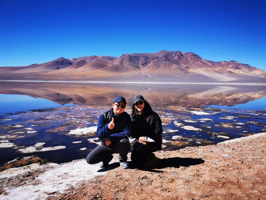
- The tour reaches serious altitude: Stops and viewpoints rise from about 4,200 to 4,500 meters, so this is not a casual lowland outing.
- Licancábur is the early star: You get a clear look toward the famous cone while climbing toward Paso de Jama.
- Flamingos are part of the route: Small high-altitude lakes can hold flamingos and other birds.
- The Pakana formations are unusual: The Moai of Tara and Cathedrals of Pakana are volcanic rock structures shaped by ancient geological events.
- Salar de Tara is the stated destination: Confirm the exact route before departure, since one booking did not reach the salar as expected.
- Guide quality matters: Pedro received especially strong praise, while English interpretation has been uneven on some departures.
From San Pedro to the high road at Paso de Jama
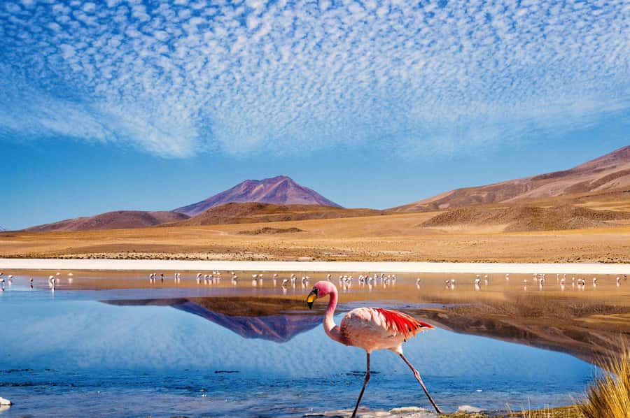
Pickup begins at about 8:00 in San Pedro de Atacama. The price includes hotel pickup in downtown San Pedro, including hotels, apartments, and other accommodations in the central area. You travel in shared transportation, not a private car, so expect the pace and comfort of a group outing.
The route follows the international road toward Paso de Jama, with a Chilean border control point along the way. You are visiting the border region, but the experience described here is a Chilean excursion to the high altiplano, not a border-crossing tour.
As the road rises, the ground becomes a broad sweep of lava and ash. The climb is steady rather than dramatic, but the altitude is the important fact. At around kilometer 41, the route reaches roughly 4,200 meters and offers a wide view back toward the Salar de Atacama and the oasis around San Pedro.
That first high viewpoint helps you understand the region. San Pedro’s green oasis looks small against the surrounding desert, while the salt basin stretches across the lower country. You will want a jacket and sun protection here, even if the morning started pleasantly in town.
Breakfast is one of the pleasant touches. A German visitor particularly liked eating with a view of Licancábur, whose upper slopes were lightly covered with snow at the time. The exact breakfast setting can vary with the day’s route and conditions, but the idea is excellent: you are not simply stopping for food, you are eating in front of one of the area’s most famous volcanoes.
More Lagoon Trips in San Pedro de Atacama
- Piedras Rojas, Altiplanics Lagoons & Salar Full-Day Tour
★ 4.7 · 592 reviews - San Pedro Atacama: Baltinache Lagoons
★ 4.6 · 359 reviews - Triple tour: Red stones, highland lagoons and Chaxa Lagoon
★ 4.7 · 219 reviews
Licancábur Volcano and the Hito Cajón turnoff
Near kilometer 41, the route passes the turnoff toward Hito Cajón and the northern side of Licancábur. The volcano’s height, 5,916 meters, gives it a powerful presence. Its near-symmetrical volcanic form is easy to pick out from the open plateau, and it provides the clearest visual landmark of the morning.
This is also where the altitude becomes more than a number on the itinerary. At 4,200 meters, some people feel fine, while others develop a headache, shortness of breath, dizziness, or nausea. One passenger described having difficulty with the height during the outing, and the guide did not always check in with everyone about how they were feeling.
You should take that responsibility seriously. Drink plenty of water before the tour, move slowly at each stop, and tell the guide at once if you feel ill. One person said drinking four to five liters of water the day before helped, though you should use sensible judgment and not force excessive water. The tour is not suitable for children under 10, pregnant women, or people with high blood pressure.
The route has several stops, so you will repeatedly get out and back into the vehicle. That is useful for photographs, but it can become tiring at this altitude. If you have limited mobility or tend to struggle in thin air, ask detailed questions before paying.
Flamingo ponds at kilometer 75
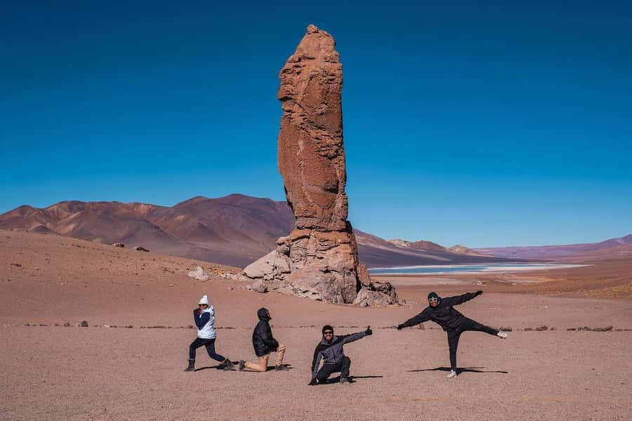
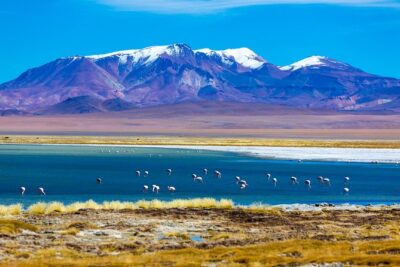
Around kilometer 75, the road reaches small lakes where flamingos and other birds may be present. These are not the broad, easy-to-reach wetlands you might picture. They are high-altitude pools set among dry volcanic country, which makes any flash of pink especially memorable.
The birdlife is valuable because it breaks the stereotype of the Atacama as empty. The altiplano supports plants and animals adapted to cold nights, strong sun, thin air, and scarce water. The tour highlights local flora and fauna, and these ponds are the best chance on the route to see that living side of the region.
Sightings are not guaranteed. The information specifies that flamingos are common, but nature does not follow a timetable. Bring binoculars if you have them, though the tour does not list binoculars as included. A camera with a useful zoom will be more helpful than relying only on a phone.
Your guide’s explanations can make a big difference here. The excursion operates in Spanish and English, but the standard of translation may vary. One English-speaking passenger found that a guide sometimes translated only the last word or fragment of a Spanish explanation. If you speak some Spanish, you may get more from the commentary. If you speak only English, ask at the start how the guide will handle both languages.
The Pakana hills and the Moai of Tara
Near kilometer 91, the route passes through the Pakana hills. The rock changes shape again, and the road reaches the Farellón of Tara, a wall of rock carved into sculptural forms by geological forces.
The Moai of Tara, also called the Pakana Witness, are a group of tall stone columns. Their name comes from their resemblance to the famous statues of Easter Island, but these are natural formations, not carved monuments. They were preserved through geological time as evidence of volcanic activity during the Tertiary period.
This is a good example of why the route is more than a salt-flat photo stop. You see the result of ancient volcanic events in forms that can look almost deliberate. The dry air, clean horizon, and lack of buildings let you focus on the rock itself.
Do not expect a long walk through a developed attraction. The experience centers on roadside viewpoints and short stops, with repeated entry and exit from the shared vehicle. That arrangement keeps the route moving, but it also means the guide has to explain the formations well and give the group enough time to look.
The most praised part of this outing is the scenery. A German passenger simply singled out the views, while an Austrian passenger gave special credit to guide Pedro and described the whole outing as thoroughly enjoyable. That contrast is useful: the setting is consistently the main reason to come, while the guide can determine how much meaning you take away from it.
More lagoon and salt flat days from San Pedro de Atacama
- Red Stones and Altiplanic Lagoons
★ 5.0 · 151 reviews - San Pedro de Atacama: Red Rocks & Altiplano Lagoons Day Trip
★ 4.9 · 108 reviews - Altiplanic Lagoons & Piedras Rojas Tour from San Pedro de Atacama
★ 4.5 · 87 reviews - Full Day Tour Piedras Rojas Altiplanic Lagoons Chaxa Lagoon
★ 5.0 · 75 reviews
Cathedrals of Pakana and Salar de Tara
A little farther on, you reach a viewpoint toward the Cathedrals of Pakana. These are another set of striking rock formations, shaped into towers and walls by erosion and volcanic history. The name helps you read the forms as architecture, but the real interest is their natural origin.
The route then continues to Salar de Tara, listed at about 4,500 meters. Here the salt basin and surrounding rock create an unusual ecosystem. Flamingos are among the most common birds noted for the area, and the broad open setting gives you a strong sense of the altiplano’s scale.
This is the point where you should confirm the exact plan before departure. The route description says Salar de Tara is the destination, but one person reported that the group did not reach it. That may have been connected to timing, route conditions, or an operational change, but the practical lesson is simple: ask the guide in San Pedro to confirm whether Salar de Tara is definitely included that day.
If reaching the salar is your main reason for booking, do not treat it as a minor detail. The Pakana formations and Licancábur views are worthwhile on their own, but they are not the same experience. A quick confirmation can prevent disappointment.
What the $78 price really covers
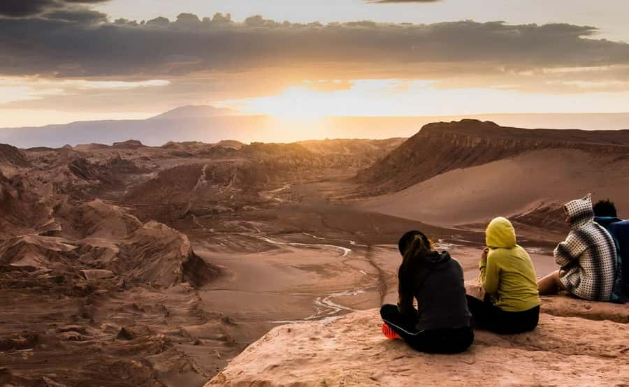
At $78 per person, this is a reasonable price for a high-altitude day outing if the listed inclusions are delivered. You get pickup, shared transportation, a Spanish-English guide, breakfast, and a snack. Those basics matter because the route is remote and the morning starts early.
The value depends on what you want. If you mainly want dramatic scenery without arranging a vehicle, food, and a local guide yourself, the price is attractive. The route covers a large area and reaches places that would be difficult to connect independently in one short outing.
The price does not include tickets, meals beyond the stated breakfast and snack, or drinks. The information does not specify which tickets may apply, so ask before departure rather than assuming every entrance cost is covered. Carry your own water and any food you may need, especially because altitude can affect your appetite and energy.
Shared transport keeps the price down, but it also introduces compromises. People seated at the back may have trouble hearing questions and answers. One passenger found it difficult to follow the guide from the rear of the vehicle and felt unable to ask questions easily. If you want detailed commentary, try to sit where you can hear clearly, and speak up early if the guide is too quiet.
Timing, altitude, and what to bring
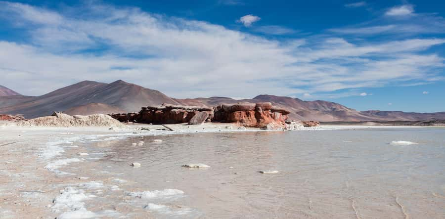
The listed duration is six hours, although the experience is also presented as a full-day route. Treat six hours as the stated operating time and confirm the expected return when you book. With an 8:00 departure, the morning has to cover the drive, several viewpoints, breakfast, wildlife stops, and the high salt basin.
Bring your passport or ID card. This is specifically required, and the route includes Chilean border control near Paso de Jama. You should also bring water, warm layers, sun protection, sturdy shoes, and a phone or camera. The official requirements list only a passport or ID card, but the high plateau calls for more practical preparation.
The temperature can change sharply between San Pedro and the altiplano. Sunlight may feel intense, while wind and cold at a high stop can make you reach for another layer. Sunglasses and sunscreen are sensible because there is little shade.
The route is not suitable for children under 10, pregnant women, or people with high blood pressure. Anyone with a medical condition affected by altitude should get medical advice before booking. The guide may offer local plants or herbs at the end, and one person said a herb provided on request helped with the effects of the height, but do not treat that as medical care or a substitute for taking symptoms seriously.
Free cancellation up to 24 hours before departure and reserve-now, pay-later booking make the commitment easier, particularly when your San Pedro schedule is still changing. Those policies do not solve the altitude issue, however. The right question is not only whether the booking is flexible, but whether your body is ready for 4,500 meters.
Who will enjoy this route most
I would choose this outing if you want a big scenic sweep and are happy with a shared vehicle, short stops, and a high-altitude setting. Photographers will find plenty to work with: Licancábur, flamingos, salt, volcanic rock, and the unusual Pakana formations all have different shapes and colors.
It also suits you if you want to see more than the best-known sights close to San Pedro. The route reaches a remote border region and gives you a taste of the altiplano’s plants, birds, volcanic remnants, and salt basins in one compact outing.
I would be more cautious if you need a slow pace, close medical support, or consistently detailed English commentary. The altitude is real, the group may be hard to hear from the back, and translation quality has not been uniform. The tour is also a weaker choice if Salar de Tara is your one non-negotiable sight unless the operator confirms that day’s route.
The strongest operational sign is the praise for guide Pedro. If he is leading your departure, you may get a warmer and more engaging experience. Since guide assignment is not guaranteed here, ask who will lead the trip and how Spanish-English interpretation will work.
Should you book the Salt Flats Route?
Book it if your priorities are Licancábur, high-altitude scenery, flamingos, and the Pakana rock formations at a price that includes transport and basic food. The scenery earns the attention, and the route packs several distinct sights into six hours.
Think twice if you are sensitive to altitude, need a relaxed schedule, or expect every stop and explanation to run exactly as described. Confirm Salar de Tara, ask about the guide, carry plenty of water, and take the health warnings seriously.
For a prepared visitor who wants a concentrated taste of the Chilean altiplano, this is a good-value choice. Just remember that the scenery is the dependable part. The exact route and quality of the commentary deserve a quick check before you set out.
FAQ
How long does the Salt Flats Route take?
The activity is listed as six hours, with departure from San Pedro de Atacama at about 8:00.
What altitude does the tour reach?
The route reaches about 4,200 meters near the Licancábur turnoff and about 4,500 meters at Salar de Tara.
Is hotel pickup included?
Yes. Pickup is included from hotels, apartments, and other accommodations in downtown San Pedro de Atacama.
What languages does the guide speak?
The live guide service is available in Spanish and English.
What should I bring?
You must bring your passport or ID card. You should also prepare for high altitude and changing conditions by carrying water and suitable clothing.
Who should not take this tour?
The activity is not suitable for children under 10, pregnant women, or people with high blood pressure.
More Full-Day in San Pedro de Atacama
- Full Day Tour to Geyser del Tatio, Vado Putana and Machuca
★ 5.0 · 134 reviews - Full Day Tour to Ruta de los Salares
★ 5.0 · 105 reviews - Andean Saltflats full-day with breakfast and lunch
★ 3.6 · 6 reviews - Piedras Rojas, Altiplanics Lagoons & Salar Full Day Tour
★ 4.4 · 3 reviews
Just added around San Pedro de Atacama
- Vallecito★ 4.7 · 13 reviews
- Valle de la Luna: A Moon-Like Escape in Atacama★ 5.0 · 3 reviews
- Atacama Desert and Magic Bus Visit★ 4.8 · 15 reviews
- San Pedro de Atacama: Valle de la luna★ 3.0 · 3 reviews
- San Pedro de Atacama: Half day Valle de la Luna, Afternoon Tour★ 4.5 · 52 reviews
- Valley of the moon★ 5.0 · 50 reviews
- Piedras Rojas and Altiplanic Tour★ 4.5 · 38 reviews
- Unique 3-Day Tour in San Pedro de Atacama★ 4.5 · 43 reviews
Altiplanic Lagoons & Salt Flats, compared.
Piedras Rojas, Altiplanics Lagoons & Salar Full-Day Tour
Read our review →
Portillo and Laguna del Inca Day Trip with Picnic
Read our review →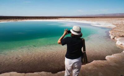
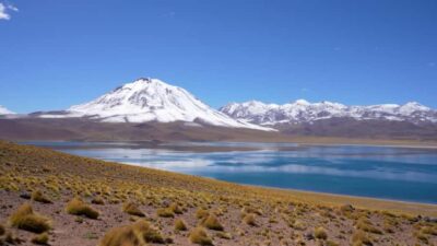
Triple tour: Red stones, highland lagoons and Chaxa Lagoon
Read our review →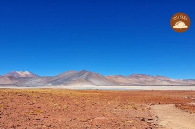
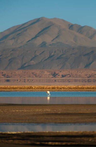
Altiplanic Lagoons & Piedras Rojas Tour from San Pedro de Atacama
Read our review →
Full Day Tour Piedras Rojas Altiplanic Lagoons Chaxa Lagoon
Read our review →Browse the lists this tour appears in